



In 1982, William Least-Heat Moon published Blue Highways, recounting his trip through America’s small towns along secondary roads that steered clear of the Interstate.
He relied on a Rand-McNally atlas to trace the rural roads printed in blue and avoid the red-outlined highways.
Fast-forward to July 2026: Morgan Pile has launched a navigation app for travelers who’d prefer to eschew the fastest route in favor of calmer, prettier, more interesting options.
The Briarcliff Manor resident recently launched Pleasant Routes, which aims to take travelers down quiet streets and scenic roads, past landmarks, parks and pretty views — whether you walk, bike or drive.
The app balances those features against time and traffic. Sometimes the fastest way is the right choice, she says. Pleasant Routes just makes sure the nicer way is visible, too.
“For years, maps have trained us to ask one question: what is fastest?” Pile, a mom and an educator, writes on her website. “It is a useful question, but it has quietly made the in-between parts of life feel disposable — the errand, the commute, the road home, the walk one block over with the trees and the old church and the little bakery.”
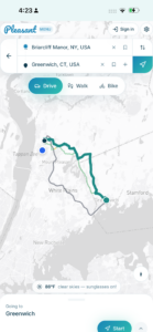
Pleasant Routes draws on a library of notable roads, walks, and local places, with strongest early coverage including the Hudson Valley, coastal Maine, California and major U.S. and international cities.
Users get a choice of three routes: direct, pleasant and scenic, with an explanation for each. It features voice-guided turn-by-turn navigation and live ETAs. Users can rate routes, flag great roads and add local tips to help the app improve over time.
Using Pleasant Routes, a driver traveling from the Town of Ossining to the Trailside Cafe on Commerce Street in Yorktown Heights can choose the fastest way: Take the Taconic State Parkway to Exit 13 and follow Underhill Avenue straight into town.
By choosing the app’s scenic route, a driver would be on the Taconic only as far as Route 134, then be directed to hilly, winding Aqueduct Road; skirt the reservoir along partially unpaved Croton Dam Road and Old Croton Lake Road; and eventually take Saw Mill River Road/118 to Underhill Avenue.
Type in Main Street in Tarrytown to Grand Central Terminal, choose the fastest route, and the app steers drivers to the highways, starting with I-87. The 29-mile trip takes 40 minutes. Got an hour for the scenic route? You’ll start out on South Broadway and later Ashford Avenue on the 31-mile excursion into Midtown.
“I am not an engineer,” writes Pile, a Brooklyn transplant who lives with her toddler, her husband and her dog. “I am not a Silicon Valley entrepreneur. And I am definitely not someone looking for more reasons to spend time on my phone.”
Pleasant Routes came from a simple frustration, she writes: “I was tired of being moved through the world on autopilot. Tired of not knowing the nooks and crannies of the places where I live, or the places I want to visit. Tired of being sent down arbitrary, forgettable roads because an algorithm decided they would save ninety seconds.”

She longed for routes that explored “the back roads, the hidden ponds, the haunted houses, the shortcuts that were not really shortcuts but were worth taking anyway.”
“Every trip felt like a small adventure,” she added.
The app is currently available free on the iOS platform through the App Store and through the website pleasantroutes.com.